"maxWidthForText"
Sets the maximum width of the shown area for which the text will be displayed.
Synopsis
void maxWidthForText(float mWidth);
Parameters
| Parameter | Description |
|---|---|
| mwidth | The maximum width |
Description
Sets up to which width the text will be displayed. The value of the width is the difference between the x-coordinates of the right and left side of the opened GIS-viewer screen.
If you set 20 for the width, the text will only be displayed if you zoom in, till the difference is 20 or smaller. That means that for instance, if the left edge of the display has the coordinate 20 and the right edge the coordinate 40, the text will be shown.
If you haven't zoomed in close enough, the text isn't displayed.
 Example
Sets the maximum text width for the layer COUNTRY and sets the text of the layer "AUSTRIA" (column STATE) visible.
main()
{
  GisViewer_ewo1.maxWidthForText = 4;
  GisViewer_ewo1.setTextVisible( "AUSTRIA", 1 );
  GisViewer_ewo1.selectShapeVarAsShapeName( "AUSTRIA", "STATE");
} 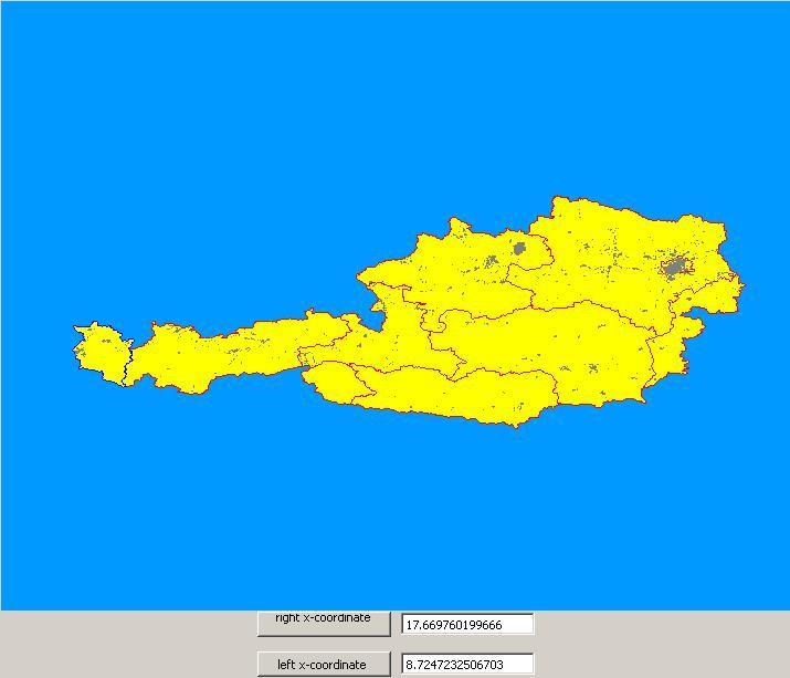
There is no text displayed, since 4 is set as the maximum difference of the coordinates and in this case, the difference is 8.9..
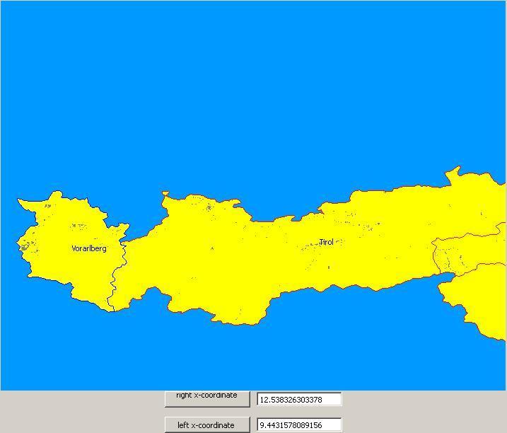
The text is displayed, because the value is less than 4.
Assignment
GIS Viewer